Inside the Android app
More ways to
explore the sky.
Look up. Rewind. Find your flight. Make the view your own. Get to know the features that bring more context to your AeroRadar experience.
Genuine Android app captures, build 1678 (0.1.1342). Screens show conditions at capture time, not a live web feed. Tap any screenshot to inspect it at full size.
01 / LOOK UP
Sky Spotter
Put a name to the aircraft overhead.
Point your phone toward the sky and explore aircraft in the direction you are looking. Sky Spotter brings available flight labels, altitude and distance into a compass-driven view.
- Browse nearby targets or search for a flight, then focus on an aircraft.
- Use the compass overlay on its own, or allow the camera for a view of the sky behind the labels.
- Follow calibration guidance to improve alignment as you move your phone.
Find it in the appMenu → Sky Spotter
Alignment depends on your phone’s sensors, calibration and available flight positions.
Back to features ↑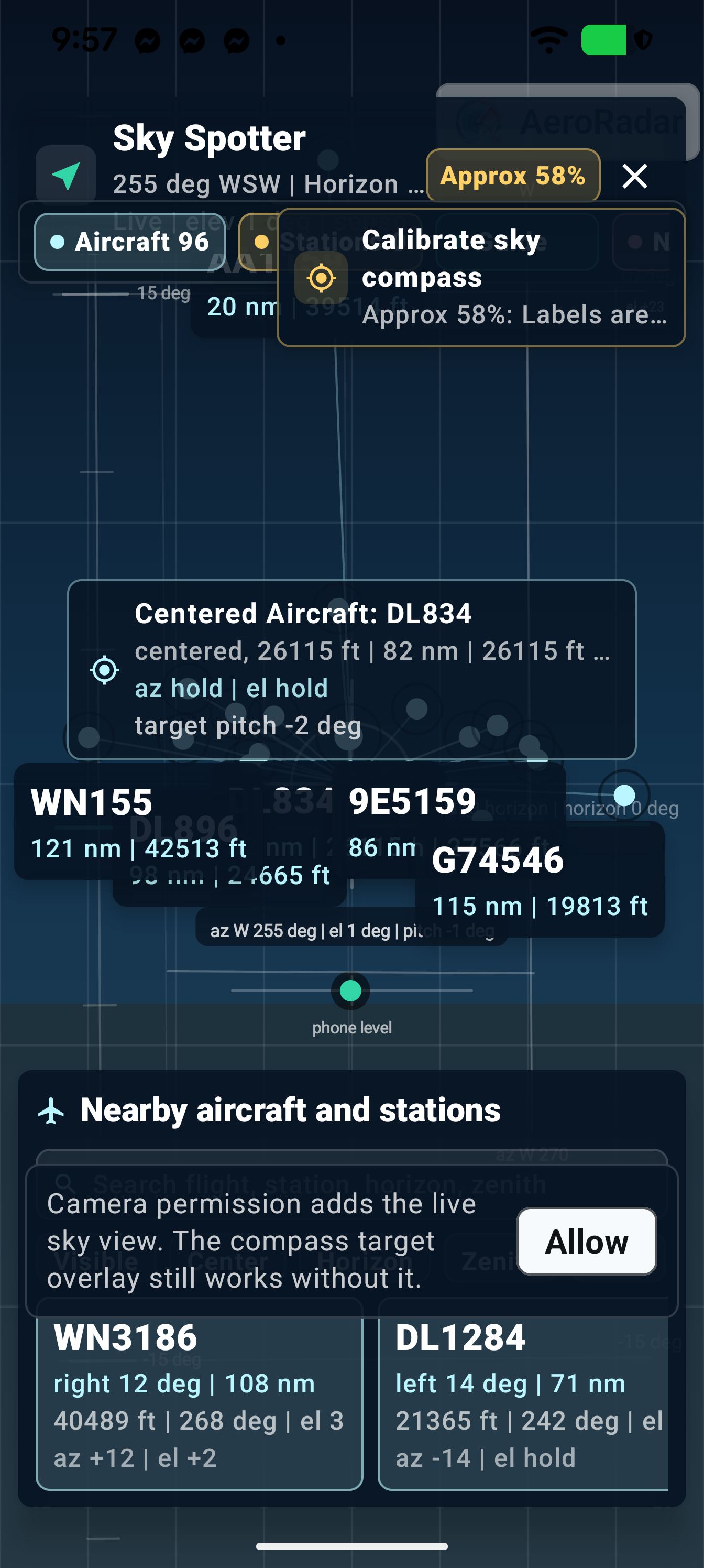
View full-size screenshot ↗
02 / PLAN YOUR TIME
Airport Pulse
Get oriented before you reach the gate.
Bring airport, terminal and flight context together. Airport Pulse helps you explore official terminal guidance and available conditions for the part of the journey that matters to you.
- Switch between Airport, My Terminal and My Flight views.
- Choose departing, connecting, arriving or pickup context.
- Explore security and access, facilities, and ground-transport information where available.
Find it in the appPulse on the map toolbar, or Menu → Airport Pulse
Official terminal facts and current conditions are labelled separately. “Not Available” means no matching current evidence; it is not a zero-minute wait.
Back to features ↑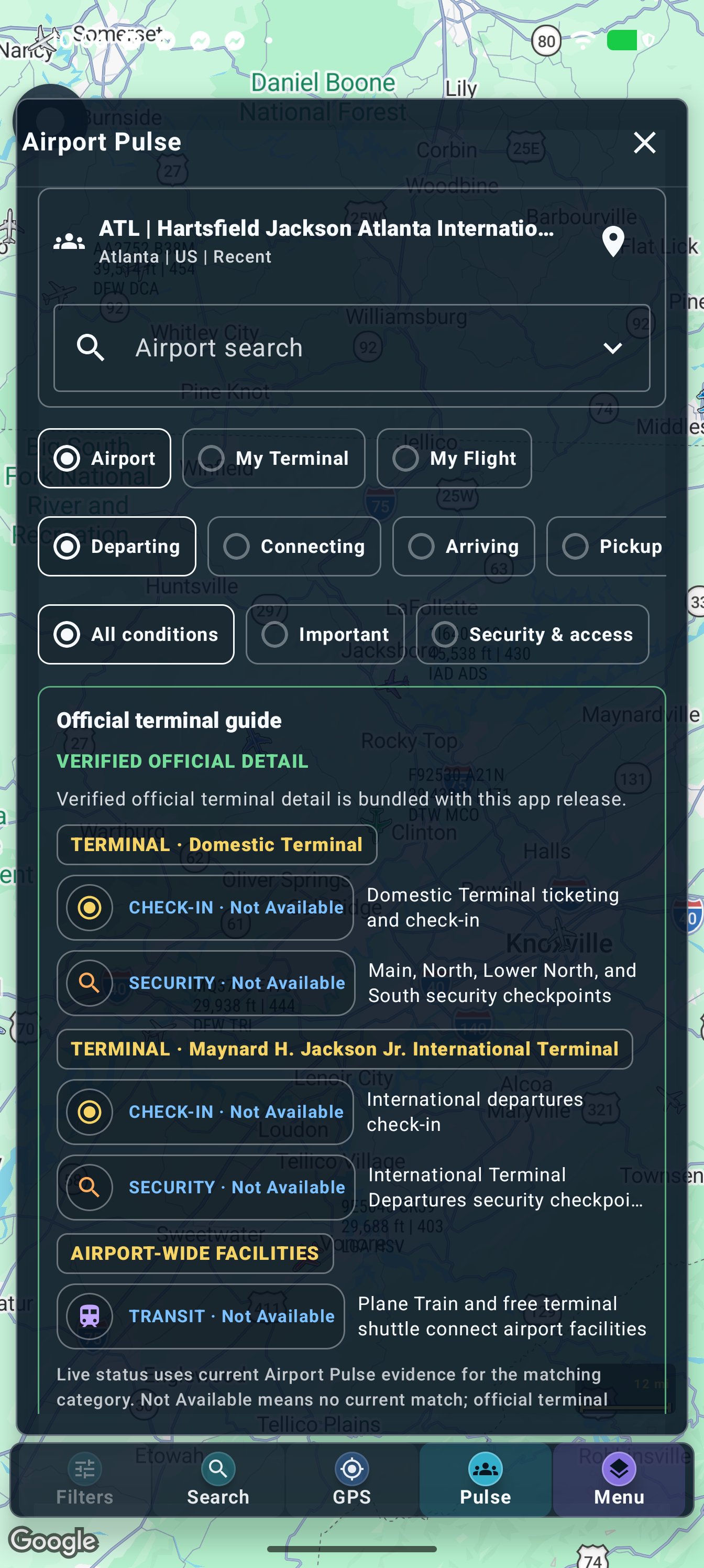
View full-size screenshot ↗
03 / WIND THE SKY BACK
Sky Replay
Watch the traffic unfold again.
Turn recent recorded traffic into a moving picture of the sky. Nearby Sky Replay lets you revisit an area, pause a moment and follow how aircraft moved through it.
- Play, pause, restart or scrub through the available timeline.
- Change playback speed and choose a lookback window from 1 to 20 hours.
- Adjust the number of aircraft labels to keep the view readable.
Find it in the appMenu → Sky Replay
Replay depends on retained observations for the selected area and time. A selectable window does not guarantee complete history for every aircraft.
Back to features ↑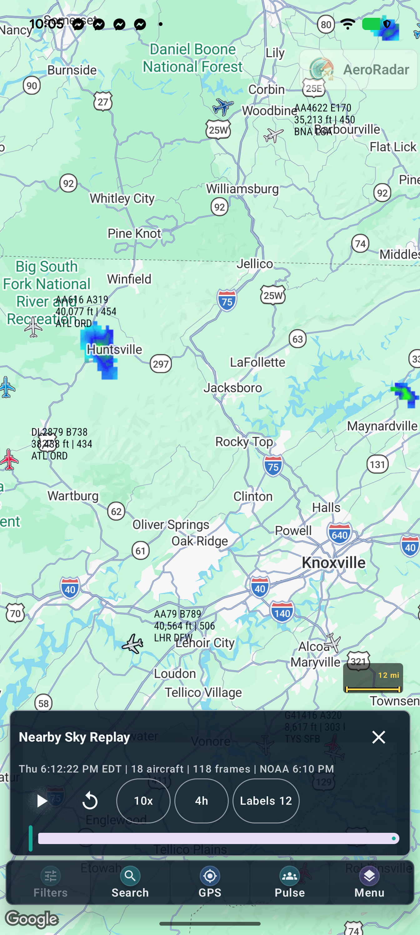
View full-size screenshot ↗
04 / FIND YOUR FOCUS
Advanced filters
Less clutter. More of what interests you.
Shape the live 2D map around the aircraft you want to follow. Combine filters or start with a smart view to narrow the traffic already loaded on your map.
- Set a minimum altitude and search by airline name or code.
- Focus on inbound destinations and aircraft types.
- Use smart views such as high-altitude traffic, one per airline or nearby private jets; clear filters whenever you want the wider picture.
Find it in the appFilters on the live 2D map toolbar
The panel shows visible versus loaded aircraft. Missing data may prevent a flight from matching a filter.
Back to features ↑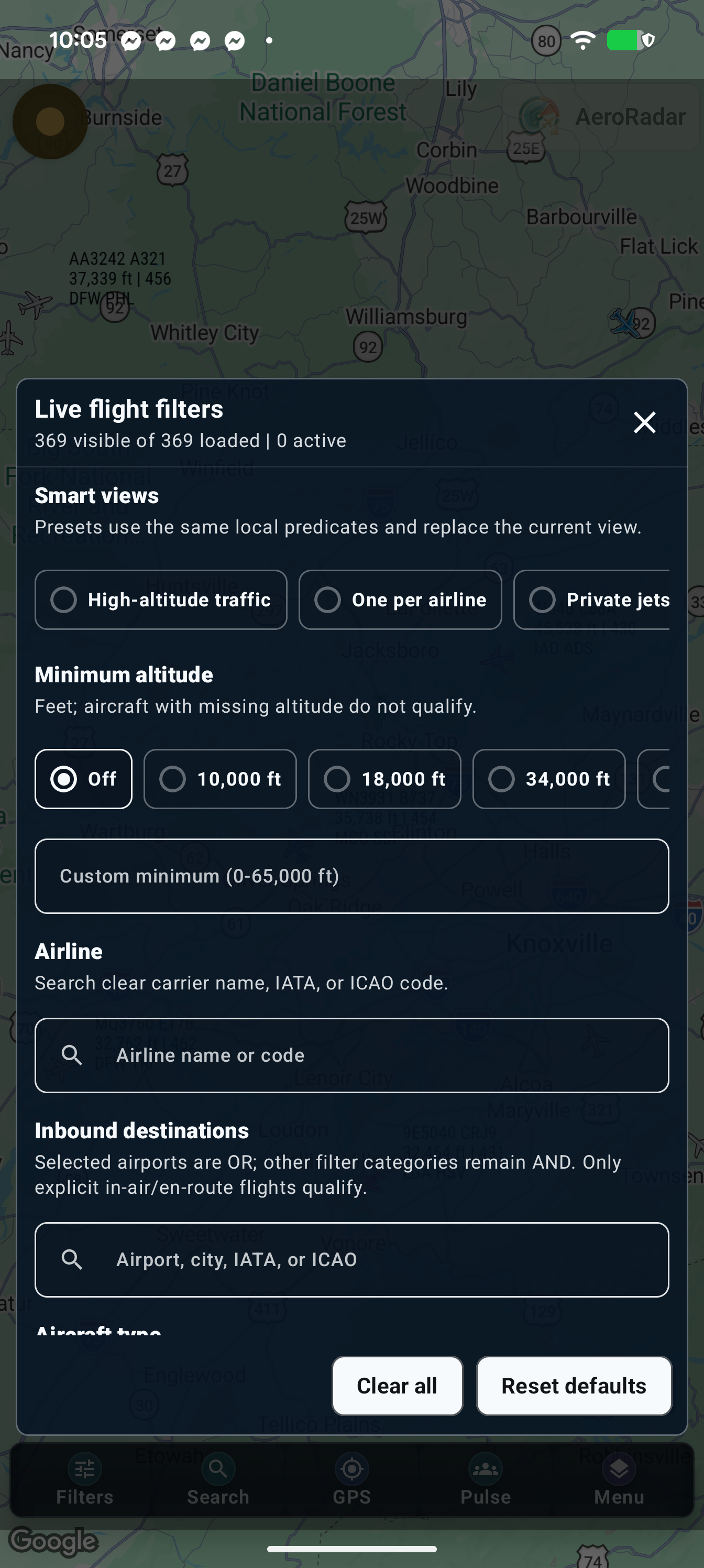
View full-size screenshot ↗
05 / READ THE MAP AT A GLANCE
Color-coded aircraft
Every color has some context.
Recognize aircraft with airline-inspired palettes and distinct category colors. A searchable guide explains the colors used by both Google and OSM 2D maps.
- Look up an airline by name or code in the aircraft marker color guide.
- Identify cargo green, private/business purple and military/operator gray category rules.
- Keep the aircraft’s colors visible while a contrasting ring highlights your selection.
Find it in the appSettings → Map and display → Aircraft marker color guide
Category rules can take priority over airline colors, and operators can share palettes. Marker colors do not indicate flight safety or delay severity.
Back to features ↑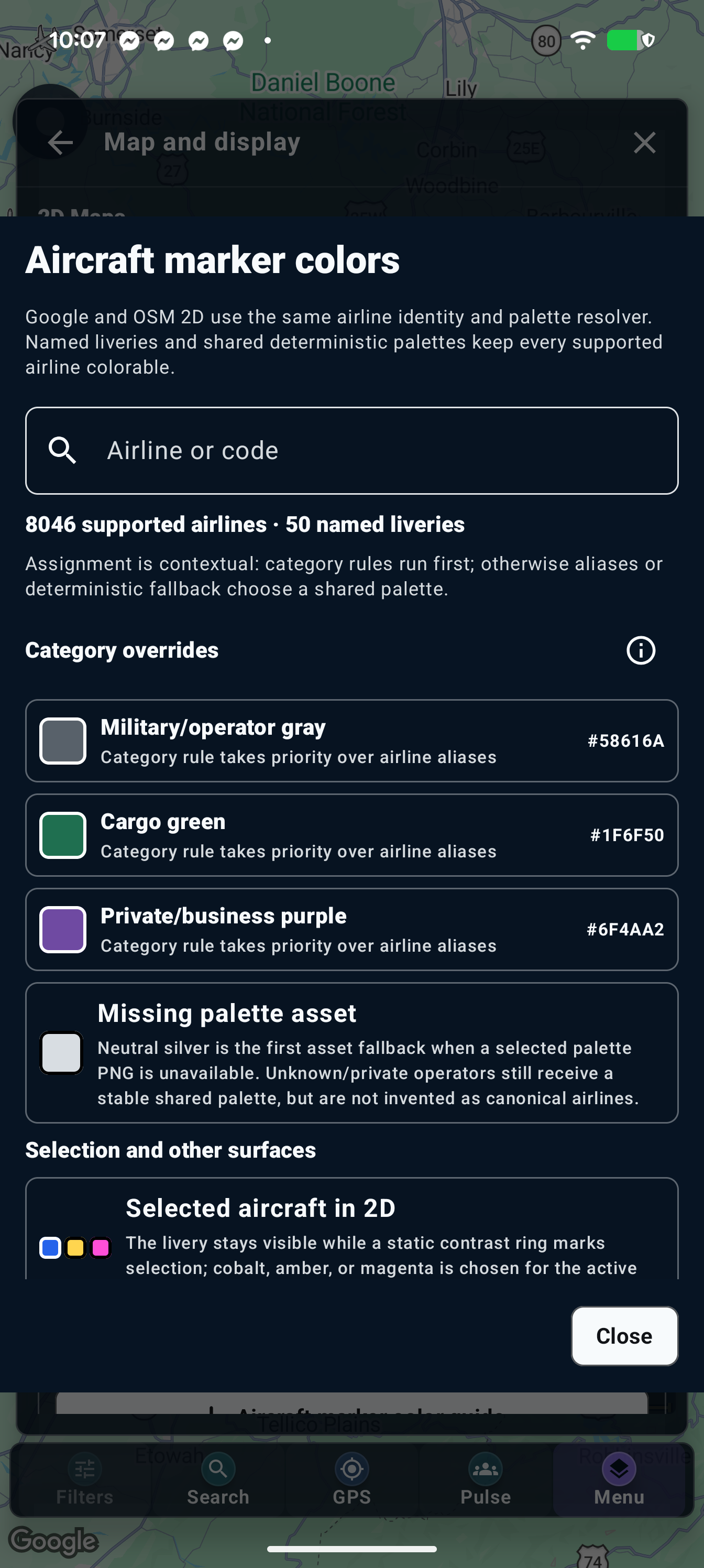
View full-size screenshot ↗
06 / MAKE IT YOURS
Customized app skins
A look that feels like your AeroRadar.
Choose a panel palette that suits you—from soft, light shades to deep night colors. Carry a consistent appearance across navigation, settings, dialogs and flight panels.
- Explore the built-in color collection and search by name, color family or hex value.
- Adjust panel opacity to balance the map and its controls.
- Choose readable text colors, with automatic contrast support for your selected palette.
Find it in the appSettings → Advanced settings → Panel appearance
These appearance controls personalize app panels; map styles and aircraft marker colors have their own settings.
Back to features ↑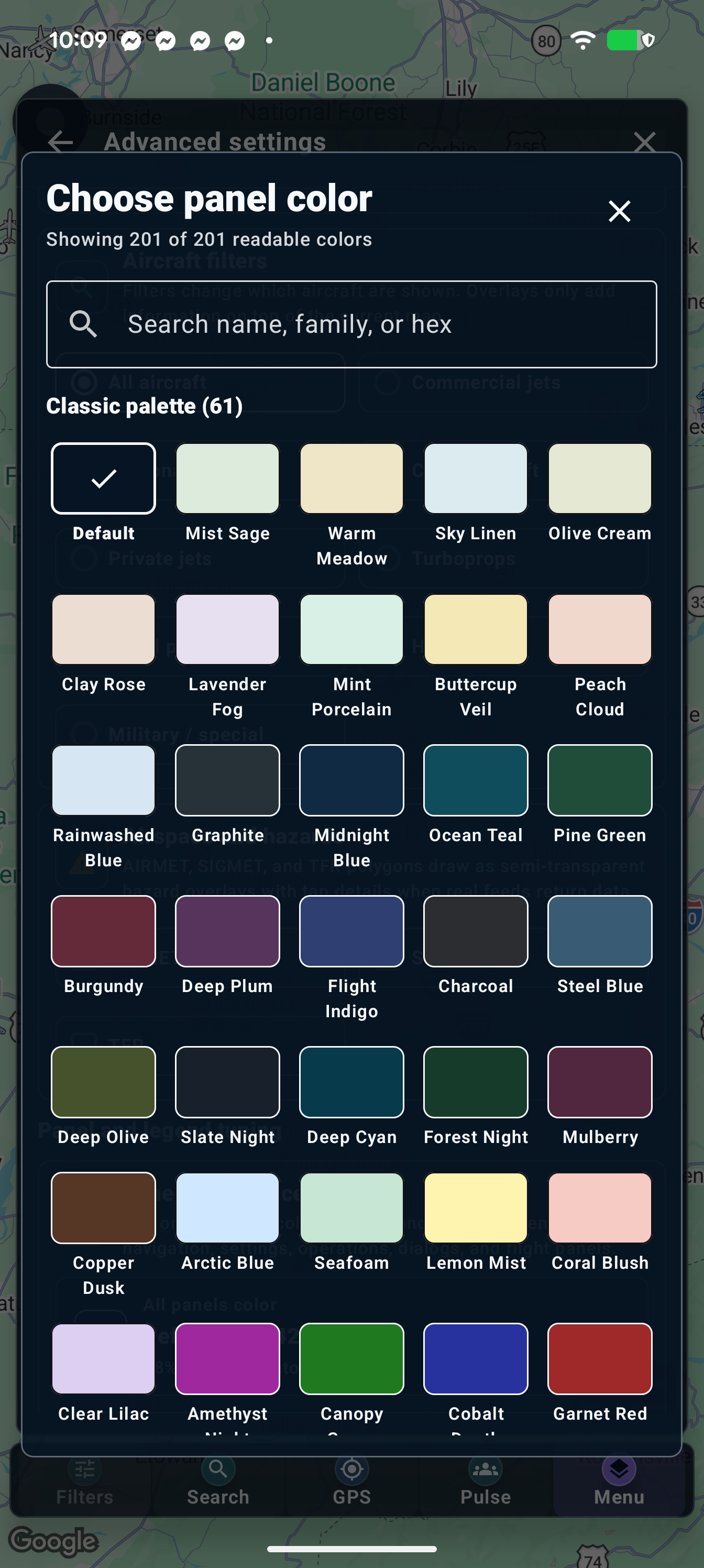
View full-size screenshot ↗
07 / FIND YOUR BEARING
Magnetic compass
A bearing beside the map.
A dial of its own.
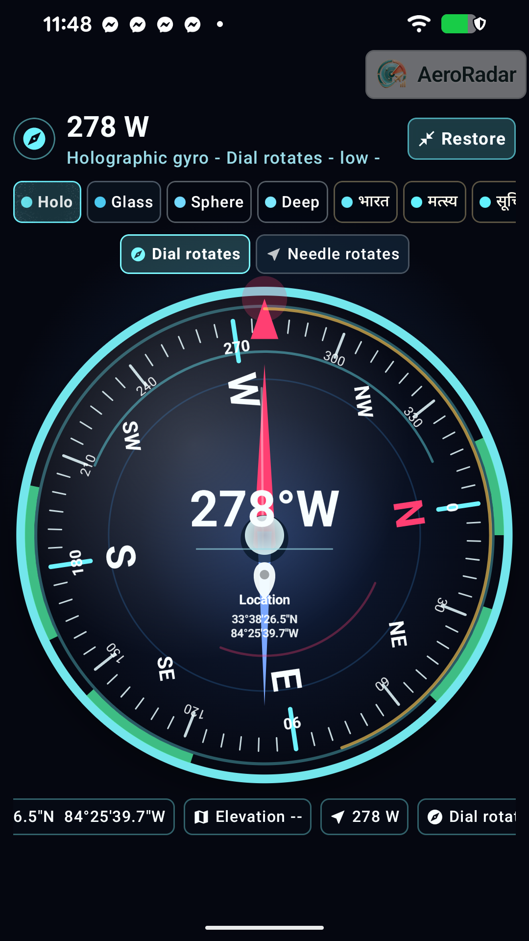
Keep a compact compass over your live map, or expand it into a full-screen instrument. Move the overlay to a convenient spot and choose the presentation that suits your view.
- Read the heading while keeping aircraft and the map in view.
- Tap the overlay to open the larger compass, then use Restore to return.
- Explore compass skins and switch between a rotating dial and a rotating needle.
Find it in the appSettings → Advanced settings → Magnetic compass tuning → Compass overlay or Full screen Compass
Optional and off by default. Heading accuracy depends on the phone’s sensors, calibration and nearby magnetic interference. For exploration, not aircraft navigation. The full-screen example shows Atlanta airport coordinates.
Back to features ↑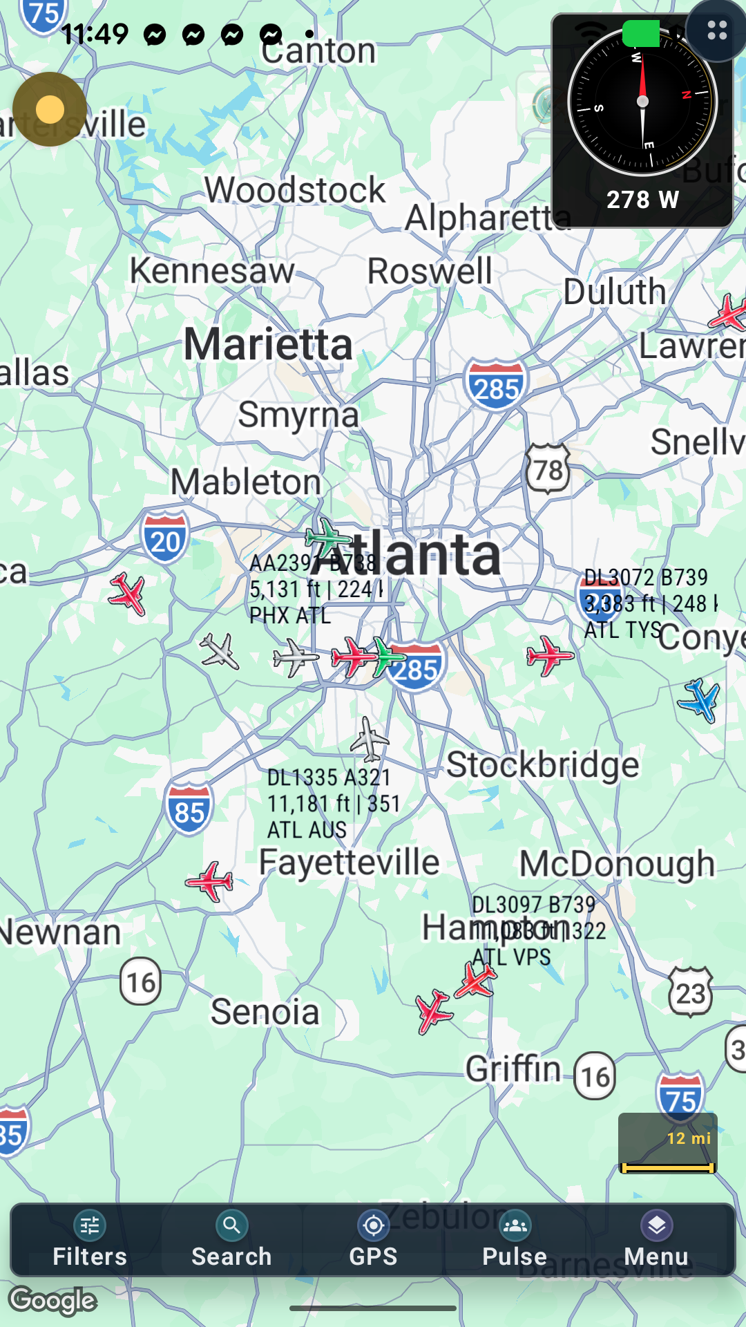
View full-size screenshot ↗
View full-size screenshot ↗
Your next perspective
Take a closer look.
For Android. Availability and access depend on your Google Play region, release track and account. Flight and airport information may be delayed or incomplete.